
Designing Resilience: Harnessing Collective Intelligence for Emergency Response
Collective intelligence for the design of emergency response
This paper explores the application of Collective Intelligence (CI) and crowdsourcing to enhance emergency response and disaster management. It proposes a framework for leveraging public participation through mobile and web technologies to provide actionable environmental data, exemplified by a "Hydrant Map" proof-of-concept for fire departments.
TL;DR
In the chaos of a disaster, the bottleneck isn't just physical resources—it's information. This paper argues that the same "Wisdom of Crowds" that powers Wikipedia can be redirected to save lives. By using crowdsourcing to map urban infrastructure and real-time threats, emergency agencies can bridge the gap between centralized planning and the ground-level reality of a crisis.
Background Positioning
While traditional disaster management relies on rigid, top-down communication structures, this work positions itself as a visionary bridge to Crisis Informatics. It advocates for a transition where the public is no longer just a group to be protected, but an active, distributed sensor network that provides critical data to first responders.
The "Invisible City" Problem
The primary motivation stems from a persistent paradox in emergency management: fire departments and police often arrive at a scene "blind." Large cities grow organically and unpredictably; a hydrant that was available last year might be blocked by new construction today.
The authors identify a critical technical and operational gap:
- Dynamic Environments: Official city maps cannot keep pace with urban shifts.
- Resource Scarcity: Agencies lack the budget to manually audit thousands of resource points (hydrants, extinguishers) regularly.
- Information Overload: While people naturally share info during crises via social media, that data is often unstructured and noise-heavy.
Methodology: The Four Pillars of Crowd Intelligence
The paper adapts Cass Sunstein’s four models of group intelligence to the disaster management lifecycle:
- Statistical (Aggregation): Averaging multiple GPS coordinates from citizens to pinpoint "potholes" or "hydrants" with high precision.
- Deliberative (Discussion): Using forums for pre-disaster risk assessment and prevention planning.
- Market (Prediction): Utilizing "prediction markets" where individuals bet on which areas are most likely to flood, often outperforming expert models.
- Volunteer (Direct Feed): Real-time "citizen journalism" feeds (Twitter/SMS) providing live situational updates like "rooftop collapse."
The Framework in Action
The authors map these methods across the cycle of crisis management:
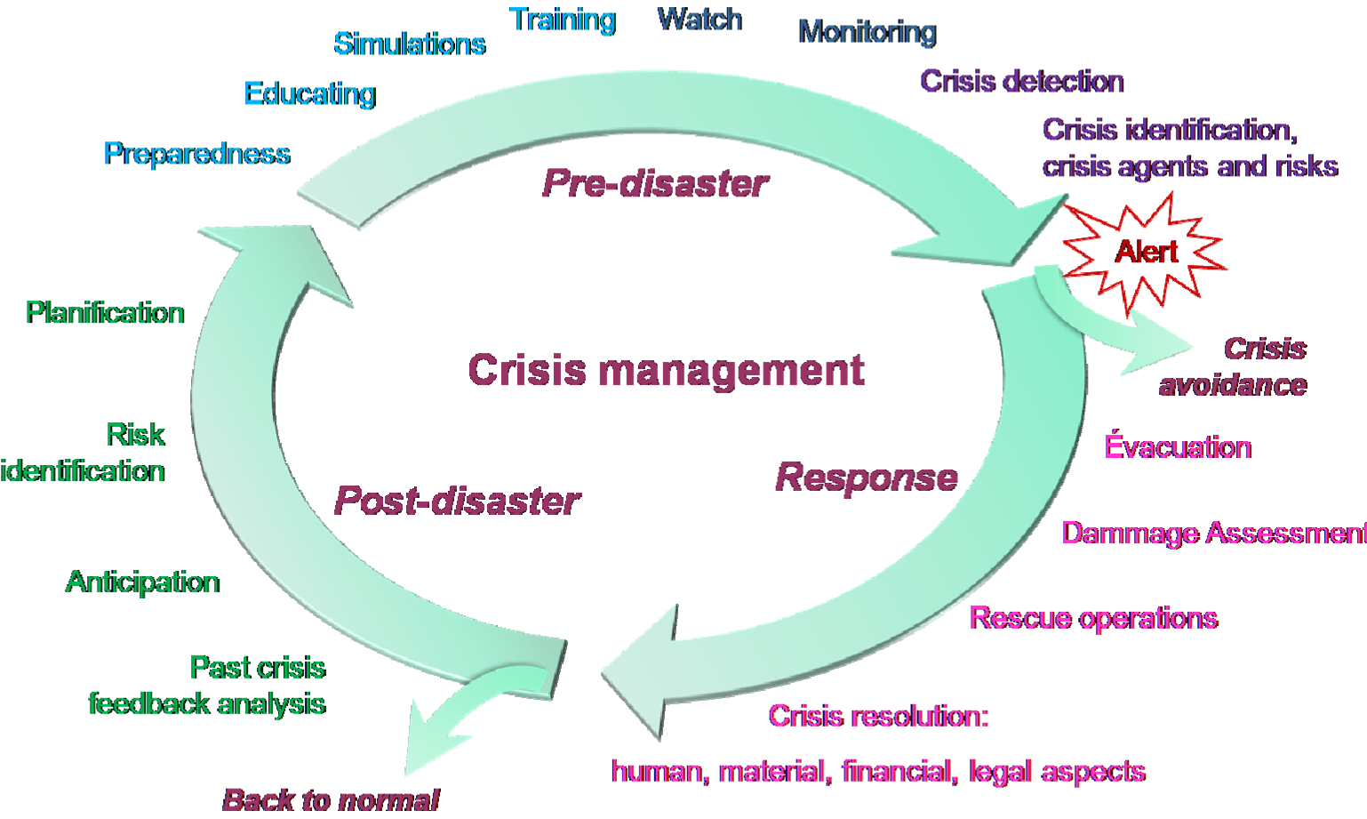
Core Application: The Hydrant Map Mashup
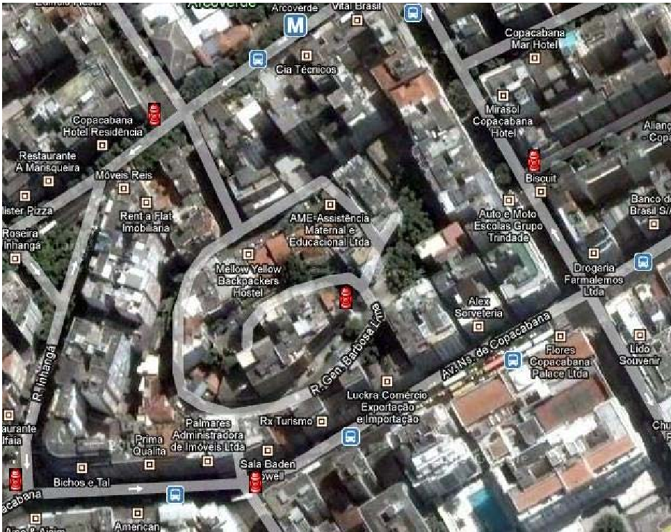
To prove the concept, the authors present a scenario involving the Fire Department. Instead of sending a scout to find water sources during a fire, the department utilizes a database populated by "hydrant sightings" reported by citizens via GPS-enabled phones.
Why it works:
- Redundancy as Verification: One report might be a mistake; ten reports in a 5-meter radius form a reliable cluster.
- Low Friction: Users simply "drop a pin" on a Google Maps interface or send a tagged message.
Experimental Insights & Limitations
The researchers highlight that the success of CI in disasters isn't just about collecting data—it's about curation.
- Information Overload: If thousands of people tweet during a fire, the commander cannot read them all. The paper suggests that Data Mining and Clustering are necessary layers to extract actionable intelligence from the noise.
- Reliability: The system relies on the assumption of "convergent behavior"—the tendency for people to collaborate during emergencies. However, malicious or incorrect data remains a risk that requires algorithmic cross-referencing.
Critical Analysis & Conclusion
This paper serves as an early blueprint for what we now recognize as Smart City Resilience. Its core takeaway is that the "crowd" processes information in a way that centralized systems cannot: through massive, parallel, and local observation.
Future Outlook: For researchers and developers, the next frontier is not just "collecting" this data, but the automated validation of it. As we move toward 2026, integrating this human intelligence with AI and IoT (Internet of Things) will be the key to reducing response times from minutes to seconds.
Takeaway for Practitioners: Don't just build a database; build a community. The most valuable map of a city is the one updated daily by the people who walk its streets.