
CommYouTer: Navigating the Chaos of Informal Public Transit via Crowdsourced Intelligence
Data crowdsourcing and traffic sensitive routing for a mixed mode public transit system
The paper introduces CommYouTer, a crowdsourcing-driven Android application designed for public transit data collection and traffic-sensitive navigation in Manila. It utilizes a modified RAPTOR (Round-Based Public Transit Routing) algorithm integrated with real-time user-contributed traffic reports and automated activity detection via smartphone sensors.
TL;DR
Navigating public transit in cities like Metro Manila is often more of an art than a science due to lack of schedules and informal route names. This paper introduces CommYouTer, a system that uses "Transit Journaling" to gather data via crowdsourcing and implements a traffic-sensitive version of the RAPTOR algorithm to provide smarter commuting directions based on real-time conditions rather than static, often inaccurate timetables.
Problem & Motivation: The "Informal" Data Gap
In most developed cities, transit apps rely on the General Transit Feed Specification (GTFS). However, in Manila, GTFS data is limited. Key pain points include:
- The Hidden Network: Modes like UV Express and Tricycles are completely missing from formal datasets.
- Aliasing Issues: Formal route names (e.g., street intersections) mean nothing to locals who look for informal headsigns/landmarks.
- The Schedule Myth: Most vehicles are headway-based (they leave when full), making traditional schedule-based routing algorithms useless during peak-hour traffic jams.
The authors' insight was to treat every commuter as a mobile sensor, capturing not just their location, but their physical activity to map the city's pulse in real-time.
Methodology: The Core Architecture
The CommYouTer system consists of a Java-based backend and an Android client. The technical "secret sauce" lies in two areas:
1. Automated Transfer Detection (Activity Recognition)
To minimize user effort, the app detects when a user switches vehicles. By polling the accelerometer at 20 Hz and applying a Discrete Fourier Transform (DFT), the system extracts features (specifically in the 1-3 Hz range, which corresponds to human walking).
- The Logic: If the system detects >4.5 seconds of walking between two significant movements, it flags a "transfer point." This allows commuters to record journeys "hands-free."
2. Traffic-Sensitive RAPTOR
The standard RAPTOR (Round-Based Public Transit Routing) algorithm is designed for fixed timetables. The authors modified it for headway-based systems by introducing a dynamic scale factor . This factor adjusts the travel time estimates based on real-time user reports of "traffic flow" at specific stops.
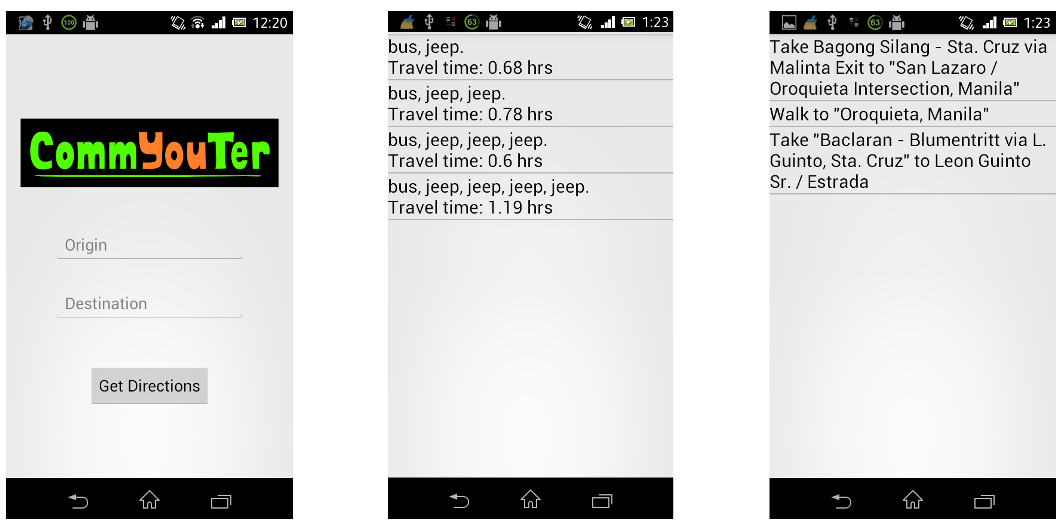 Fig 1: The CommYouTer mobile interface showing the search and journey planning process.
Experiments & Results
The system was tested in the "wild" of Metro Manila. The most compelling result was the algorithm's ability to adapt to congestion.
- Routing Accuracy: In a scenario where Journey B was 3.3km shorter than Journey A, a simulated traffic report of 10 km/h at a bottleneck caused the system to correctly re-route the user to Journey A.
- User Satisfaction: 92% of users found the results useful, highlighting that in informal systems, perceived reliability (knowing the traffic) is more important than pure path optimality.
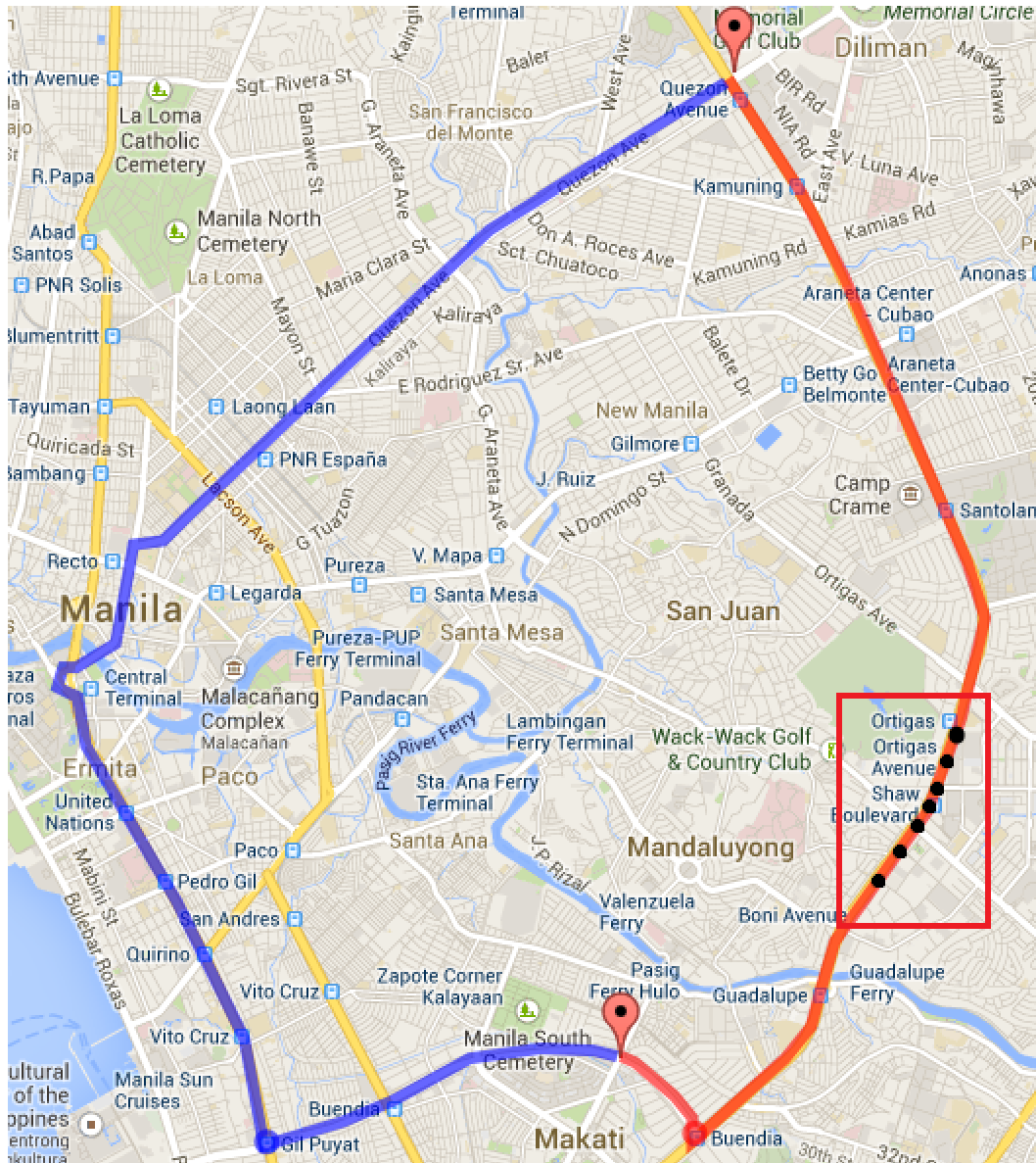 Fig 2: A comparison of two journeys where Journey B (right) becomes less optimal after traffic reports (black dots) are integrated.
Critical Analysis & Conclusion
Takeaway
CommYouTer proves that even in environments where government data is sparse, high-quality routing is possible by leveraging the "flock" of commuters. The transition from static graphs to dynamic, crowdsourced weights is a necessary step for smart city development in the Global South.
Limitations & Future Work
The current model relies on straight-line Haversine distances, which can be inaccurate on winding roads. Furthermore, the system currently assumes a constant average speed when no traffic reports are available. Future iterations could benefit from:
- Historical Correction: Using archived user data to predict traffic patterns when real-time data is missing.
- Preference Weighing: Allowing users to prefer specific vehicle types (e.g., "Air-conditioned bus" over "Jeepney").
- Auto-Mapping: Using aggregated GPS traces to automatically build maps for previously undocumented tricycle routes.
Final Thought: CommYouTer is not just an app; it's a framework for democratizing urban navigation where official infrastructure fails to keep pace with city growth.