
Environmental Intelligence: De-risking the "Build Back Better" Investment Surge
Environmental Intelligence for more Sustainable Infrastructure Investment
This paper introduces the EC H2020 ReSET project, which leverages Environmental Intelligence (EI) to optimize sustainable infrastructure investment. By integrating IoT monitoring (FreeStation), spatial policy support systems (Co$tingNature, Eco:Actuary), and AI-driven land classification, the framework evaluates the trade-offs between "grey" (built) and "green" (nature-based) infrastructure across multiple European demonstration sites.
TL;DR
As global economies move to "Build Back Better" post-pandemic, the ReSET project introduces a sophisticated Environmental Intelligence (EI) framework. By fusing IoT sensors, AI-driven satellite analysis, and spatial modeling, it provides investors with a data-driven roadmap to balance traditional "grey" infrastructure with "green" Nature-Based Solutions (NbS) for maximum social and environmental ROI.
The Motivation: Moving Beyond "Vague Green" Principles
Everyone agrees on "sustainability," but few know how to price it. The core challenge is that investors require quantitative intelligence—ROI, employment impact, and risk mitigation—while nature is notoriously difficult to quantify in a spreadsheet.
The authors argue that the current path leads to "wicked" problems: cities that are economically active but biologically pauperate and climatically unstable. To fix this, we need more than just data; we need Intelligence, defined here as the ability to learn and manage new situations through reasoning based on multiple data streams.
Methodology: The ReSET Stack
The paper outlines a multi-layered technical stack designed to turn raw environmental data into actionable policy support:
- Distributed IoT (FreeStation.org): While high-end sensors exist, they are often too expensive for local maintenance. FreeStation provides low-cost, DIY, IoT-connected designs to monitor local baselines like air pollution and thermal extremes.
- Spatial Simulation (PolicySupport.org): Using tools like Co$tingNature and Eco:Actuary, the system maps 18 different ecosystem services. It simulates "what-if" scenarios: What if we replace this concrete sea wall with a mangrove or wetland system?
- Machine Learning (AI Layer): The researchers utilize a ResNet50 neural network to perform automated feature extraction. A key breakthrough mentioned is the ability to distinguish between "grey" reservoirs (concrete-heavy) and "green" natural water bodies—a distinction vital for accurate natural capital accounting.
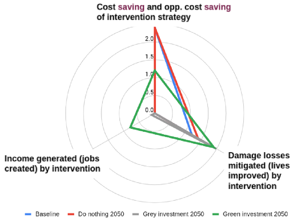 Figure 1: Conceptual framework for comparing Business-as-Usual (Grey) vs. Green investments across multiple KPIs.
From Pixels to People: The Results
The project's strength lies in its Human-Centric Modeling. Unlike traditional remote sensing that looks at "pixels," ReSET uses agent-based modeling (Metronamica) to look at "people."
- Urban Focus: In cities like Bologna and London (Strand Aldwych), the focus is on mitigating thermal extremes and noise through urban greening.
- Rural Focus: In the Carasuhat Wetlands (Romania), the focus shifts to low-impact tourism and flood management.
By quantifying "Damage Avoided" and "Jobs Created" (duration x employment number), the framework translates ecological health into the language of the European Commission and private investors.
Critical Analysis & The "Wicked" Problem
Despite the technological prowess, the authors are refreshingly candid about the limitations of pure tech:
- The Technology Trap: Research often gets "distracted" by the tech itself. ReSET positions technology strictly as an enabler, not the research goal.
- Usability vs. Complexity: Most academic "tools" are never used. The paper emphasizes Co-design with stakeholders to ensure the APIs and dashboards actually fit into the investment decision workflow.
Conclusion and Future Outlook
The ReSET project demonstrates that Environmental Intelligence is the bridge between ecological science and the boardrooms of infrastructure investors. By moving toward a "total value" approach—accounting for nitrogen filtration, flood buffering, and mental health alongside traditional GDP—we can ensure that the next trillion-dollar infrastructure cycle doesn't bankrupt the planet's future.
Takeaway for Practitioners: If you are building spatial tools, focus on transparency and scalability. The success of ReSET's WaterWorld—now 22 years in operation—highlights that accessibility and long-term data maintenance are more valuable than the most complex, black-box AI model.