
Precise Flood Mitigation: Using SAR Geoindicators to Prioritize Wetland Restoration
10347_Using Geoindicators to Prioritize Regional Wetland Locations for Flood Attenuation in Manitoba's Red River Basin.
This study adapts the US EPA framework to prioritize wetland restoration sites for flood mitigation in Manitoba’s Red River Basin. It introduces a novel "Storage Potential" geoindicator derived from RADARSAT-2 soil moisture data to identify optimal locations for hydrological attenuation, achieving high spatial precision in a low-relief agricultural landscape.
TL;DR
Researchers in Manitoba have successfully adapted an EPA-based framework to address increasing flood threats in the Red River Basin. By introducing RADARSAT-2 soil moisture data—a "Storage Potential" geoindicator—the study identifies targets for wetland restoration with unprecedented precision. The result? A strategic plan where restoring just 0.8% of the landscape can mitigate 20% of a 100-year flood's peak flow.
Context: The Cost of Drained Landscapes
In the fertile Red River Basin, agricultural progress came at a steep hydrological cost: the drainage of 98% of original wetlands. Without these natural sponges, seasonal snowmelt and sudden storms transform the flat prairie into a flood zone, causing billions in infrastructure damage. While "hard path" solutions like the Winnipeg Floodway exist, there is a dire need for "soft path" ecological restoration that is both economically viable and hydrologically effective.
The "Low-Relief" Challenge: Why DEMs Aren't Enough
A fundamental problem in Southern Manitoba is its extreme flatness—less than 42 meters of elevation change over 200 kilometers. In such a landscape:
- Digital Elevation Models (DEMs) often lack the vertical resolution to identify crucial depressions.
- Historical records are often obsolete due to massive man-made drainage alterations.
The authors hypothesized that soil moisture is a better proxy for "storage potential" than topography. If the ground is naturally holding more moisture (detectable via RADAR), it indicates a superior site for a functional wetland.
Methodology: The Modified EPA Framework
The core of the study lies in a mathematically robust Cost-Benefit Analysis (CBA) that ranks sites by Flood Volume Reduction per Restoration Dollar.
The Engine: Multi-Source Data Integration
The framework (shown below) integrates three primary terms:
- Cost of Land: Using provincial land assessment data to ensure restoration doesn't target high-value active farmland.
- Runoff Depth: Calculated using Landsat-8 for crop discrimination and Soil Conservation Service (SCS) Curve Numbers.
- Storage Potential & Stream Density: The novel inclusion of RADARSAT-2 data to map current moisture conditions and proximity to existing drainage networks.
The Innovation: RADAR for Soil Moisture
By using C-band SAR data (HH polarization), the researchers could penetrate the landscape to identify areas of saturation that were invisible to optical sensors. This "Storage Potential" layer became the filter that separated "low-cost land" from "hydrologically active land."
Experiments & Results: Efficiency Through Precision
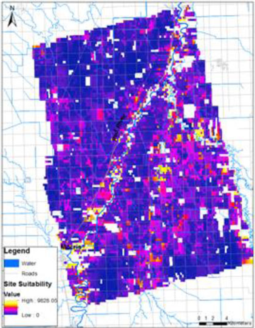
The study focused on the Morris region of Manitoba. The results were striking:
- Refinement: Adding the RADAR-derived storage indicator reduced the search area for suitable wetlands by 30%, filtering out sites that looked good "on paper" but lacked the physical capacity to hold water.
- Strategic Impact: 0.8% of the land area was identified as critical. Targeting this specific fraction allows flood managers to collaborate with landowners on a highly selective basis rather than wide-scale land acquisition.
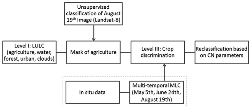 The workflow utilized multitemporal Landsat-8 data to refine crop types, directly influencing the accuracy of calculated Runoff Depths (CN numbers).
SOTA Comparison
Unlike the original EPA analysis conducted at a "synoptic" (large-scale) level, this study proves the framework is equally powerful at a regional scale. It bridges the gap between high-level policy and site-specific engineering.
Critical Insight: A New Standard for Prairie Restoration
This research underscores a vital takeaway for environmental scientists: In low-relief environments, dielectric properties (moisture) are more informative than geometry (elevation).
Limitations & Future Work
- Temporal Snapshot: The SAR data was a single-season acquisition. Future iterations should use multi-temporal SAR (e.g., Spring vs. Autumn) to distinguish between permanent saturation and seasonal flooding.
- Incentivization: While the study highlights low-cost land, the "social" cost of land conversion remains a hurdle that requires policy-driven economic incentives for farmers.
Conclusion
By blending economic data with advanced SAR remote sensing, Fraser and Storie have provided a blueprint for surgical wetland restoration. This framework doesn't just ask where we can build wetlands, but where we must build them to get the most "flood-fighting" bang for our buck.