
Map Gretel: Bridging the Gap Between Citizens and Authoritative Mapping
Map Gretel: social map service supporting a national mapping agency in data collection
The paper introduces "Map Gretel," a social map service pilot designed by the National Land Survey of Finland (NLS) to integrate Volunteered Geographic Information (VGI) into official National Mapping Agency (NMA) workflows. By leveraging a user-friendly web interface and professional quality-control pipelines, the system successfully enabled citizens to contribute high-quality topographic data, including features difficult to capture via remote sensing.
TL;DR
The National Land Survey of Finland (NLS) launched "Map Gretel," a social map service that allows citizens to directly edit and add topographic features. Unlike previous one-way feedback forms, this system integrates crowdsourced data into the professional NMA workflow. The pilot proved that VGI (Volunteered Geographic Information) can be high-quality enough for official databases and that citizens are far more productive when provided with "social" mapping tools rather than static forms.
Background: Why NMAs Need the Crowd
National Mapping Agencies (NMAs) are the "gold standard" of geospatial data, but maintaining that quality at a 1:10,000 scale is a Herculean task. Remote sensing (satellites and planes) struggles with features hidden by canopy—like forest paths—or rapidly changing local names. While platforms like OpenStreetMap (OSM) have massive participation, licensing conflicts (ODbL vs. CC-BY) often prevent NMAs from merging OSM data into authoritative datasets.
The Problem: The "Quality vs. Openness" Paradox
Historically, NMAs feared that opening their databases to the public would invite "participation inequality" (where a few users do everything) or low-quality "noise." Most NMA feedback systems were limited to point-markers and email strings, which are cumbersome for both the user and the professional operator.
Methodology: The Map Gretel Workflow
The researchers built Map Gretel to prove that a structured, social-oriented platform could solve these friction points.
1. The Dynamic Workflow
The core of the methodology is a state-machine for geospatial features. A feature isn't just "added"; it moves through a lifecycle:
- Unprocessed: Visible to all, editable by the community.
- Being Processed: Locked for review by an NMA operator.
- Transferred/Rejected: If transferred, it enters the official National Topographic Database (NTDB).
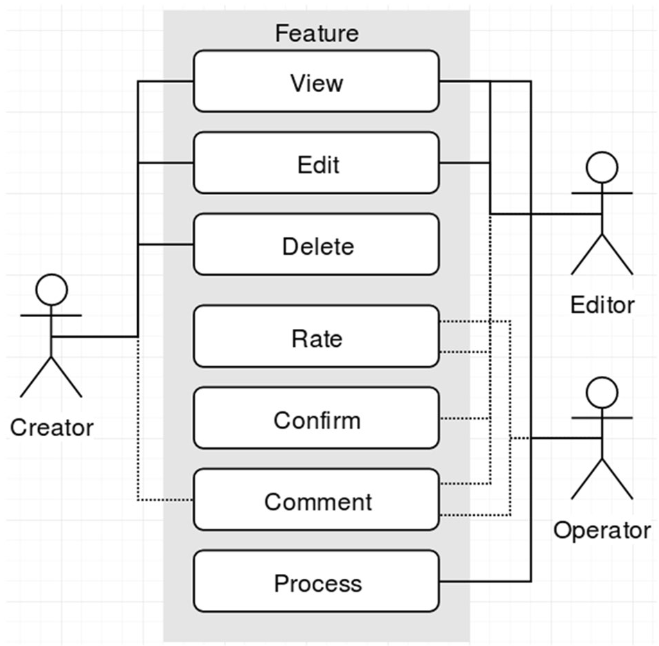
2. Social & Technical Integration
The system utilized the uMap platform but modified it to support:
- GPX Uploads: Improving geometric accuracy by allowing users to upload GPS tracks from their hikes.
- Social Features: Conceptually including "Reputation" and "Commenting" to allow operators to ask mappers for clarification—turning a data submission into a conversation.
Results: High-Quality "Citizen Sensors"
The pilot's findings challenge the stigma that VGI is low-quality:
- Volume: 950 features in 6 months (vs. ~500 per year via old systems).
- Utility: Approximately 50% of contributions were forest paths—data typically invisible to high-altitude sensors.
- Reliability: NMA operators found that over 60% of the data was useful/usable, with only a 10% rejection rate due to poor quality.
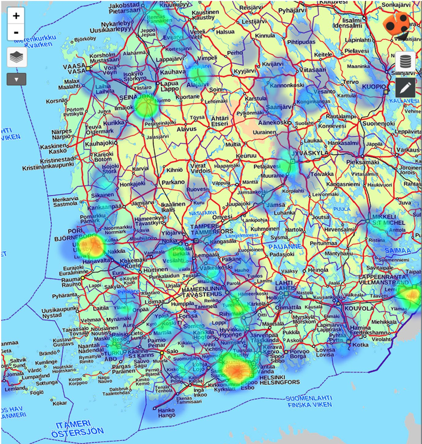 Above: Heatmap showing the geographic distribution of crowdsourced contributions during the pilot.
Critical Insight: The "Social" in Social Map Service
One of the most profound takeaways from the study is the necessity of the User-Operator relationship. The authors noted that when operators couldn't find a comment box (in the early pilot), they resorted to editing the metadata description of a feature to explain why they rejected it to the user. This "hacking" of the UI by professional cartographers shows a deep desire for developer-to-contributor interaction.
Deep Insight & Future Outlook
Map Gretel demonstrates that the future of mapping isn't just about better satellites, but about making the role of a "citizen as a sensor" fun.
Limitations: The pilot lacked a mobile app, which 67% of users requested. Furthermore, legislative hurdles like GDPR present new challenges for how NMAs handle the "personal" location data of their volunteers.
The Takeaway: To stay relevant, NMAs must pivot from being "data factories" to "community hubs." By integrating gamification (voting, ranking) and social interaction, agencies can turn a chore into an experience, ensuring their maps reflect the world as it is actually walked, not just as it is seen from above.