
IDMS: Revolutionizing Waterfowl Surveys with Integrated Drones and Deep Learning
sUAS and Machine Learning Integration in Waterfowl Population Surveys
The paper introduces IDMS (Integrated system of sUAS and Machine learning for waterfowl population Surveys), a comprehensive framework that combines modular drone path planning with deep learning architectures (RetinaNet, Faster R-CNN, Unet). The system achieves automated detection and counting of waterfowl in aerial imagery, reaching 70% to 90% accuracy across diverse datasets.
TL;DR
Researchers at the University of Missouri have developed IDMS, a specialized system that automates waterfowl population monitoring. By combining custom DJI-based flight planning software with optimized Deep Learning models like RetinaNet and Faster R-CNN, the system provides a safer, cheaper, and more accurate alternative to traditional manned-aircraft surveys, achieving detection accuracies up to 90%.
Background & Motivation: Moving Beyond Dangerous Ocular Surveys
For decades, waterfowl conservation has relied on biologists leaning out of low-flying helicopters or fixed-wing aircraft to count birds manually. This "ocular survey" method is not only prone to human error but is also statistically one of the most dangerous jobs in wildlife biology.
While small Unmanned Aircraft Systems (sUAS) offer a safer alternative, the sheer volume of data they collect creates a "bottleneck." Manually reviewing thousands of high-resolution images is logistically impossible for real-time management. The authors identified that the core challenge lies in small target detection: birds often appear as mere pixels against noisy, high-contrast aquatic backgrounds.
Methodology: The IDMS Framework
The IDMS system isn't just a model; it's a full-stack pipeline designed for the field.
1. Hardware-Aware Flight Planning
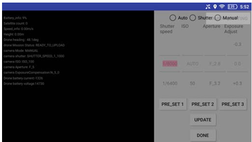
The authors developed a custom Android app for DJI drones that solves several physical constraints:
- Energy Consumption: Using an empirical power model, the app predicts if a battery can complete a survey based on speed, altitude, and turns.
- Image Clarity: It calculates the Ground Sampling Distance (GSD) to ensure birds remain identifiable, automatically adjusting shutter speeds to prevent motion blur.
2. Deep Learning Optimization
Standard models like Faster R-CNN are usually tuned for COCO-sized objects (like cars or people). To adapt them for "birds-as-pixels," the authors performed three critical optimizations:
- Anchor Resizing: They reduced default anchor sizes in RetinaNet and Faster R-CNN-FPN to tightly fit the dimensions of waterfowl at 30-120m altitudes.
- Training Sample Balancing: They discovered that a specific ratio of 1:0.2 (positive to negative patches) provided the best balance between sensitivity (recall) and avoiding false alarms (precision).
- Altitude Scaling: Images were rescaled based on their GSD values before processing, ensuring the neural network always "sees" birds of a consistent scale regardless of flight height.
Experimental Insights: RetinaNet vs. Faster R-CNN
The team curated the WAI (Waterfowl Aerial Imagery) datasets, containing over 100,000 birds across various environments.
| Model | MAP (Best) | F1-Score | Key Strength |
|---|---|---|---|
| RetinaNet | 89.53 | 85.60 | Lower count error (MAE) in most scenarios. |
| Faster R-CNN | 90.46 | 95.37 | Higher peak F1-score at lower altitudes. |
| Unet | 66.40 | Lower | Performance lagged behind state-of-the-art detectors. |
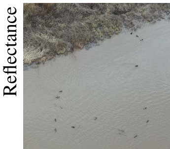
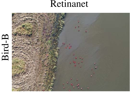
The results confirmed that while detection is nearly perfect at low altitudes (30m), higher altitudes (120m) introduce significant false positives (e.g., rocks or debris mistaken for birds), as shown in the visual results where automated counts occasionally exceeded true counts in complex terrain.
Deep Insight & Conclusion
The success of IDMS highlights a critical trend in Applied AI: domain-specific tuning beats general-purpose architecture. By realizing that "bird detection" is essentially a small-scale anchor problem and a training-sample balance problem, the authors bypassed the need for exotic new architectures.
Future Outlook: The next frontier for IDMS includes moving transition from "counting dots" to species identification (e.g., distinguishing a Mallard from a Northern Pintail) and using minimal drone sampling to estimate total abundance across massive wetland complexes.
Takeaway for Practitioners
If you are deploying CV in the field:
- GSD is Law: Your model is only as good as your resolution-to-altitude math.
- Negative Samples Matter: Don't just train on objects; training on "empty" ground (at a controlled ratio) is vital to preventing false positives in the wild.