
Location-Aware Mobile Sensing: Transforming Crowded Exhibitions into Social Experiences
Implementation of a smartphone sensing system with social networks: a location-aware mobile application
This paper presents a cross-platform smartphone sensing system designed for large-scale public venues, integrating GPS, G-sensors, and social networks (Facebook API). The system features a Dynamic Activity Recommendation (DSR) algorithm and an LBS advertising filter to optimize visitor experiences in crowded exhibitions like the Taipei International Flora Exposition.
TL;DR
Visiting massive exhibitions often means fighting crowds and following rigid, outdated maps. This paper introduces an integrated smartphone sensing system that utilizes GPS, G-sensors, and Facebook social data to provide real-time crowd-aware recommendations. By using a cost-based Dynamic Activity Recommendation (DSR) algorithm, the system directs users to less crowded exhibits while allowing them to track friends via a "Friend-Finder Radar."
Problem & Motivation: The Chaos of the Crowd
Large-scale public events, such as the Taipei International Flora Exposition, suffer from a common paradox: despite being high-tech events, navigation is often low-tech. Traditional maps provide a "one-size-fits-all" schedule that leads to:
- Bottlenecks: Most visitors follow the same path at the same time.
- Information Irrelevance: Users are bombarded with generic ads.
- Social Isolation: Finding friends in a sea of thousands is nearly impossible without constant, distracting communication.
The authors' insight was to move beyond static guides toward a crowd-sourced, interactive experience where the mobile device acts as a sensor, feeding data back into a system that benefits the entire ecosystem of visitors.
Methodology: The Core Engine
The system's intelligence relies on the synergy between local mobile sensing and a centralized database.
1. Dynamic Activity Recommendation (DSR)
The DSR is the "brain" that prevents congestion. Unlike simple navigation that finds the shortest path, DSR uses a cost function that considers both distance and crowd status:
- : The normalized distance factor.
- : The current crowd density at exhibit .
- : A weight value to balance travel effort vs. wait time.
2. Friend-Finder Radar & Social Integration
By leveraging the Facebook API via an iframe approach, the system downloads a user's friend list and queries their real-time coordinates (if shared). These are converted into a radar-style interface, providing an intuitive visual of where social contacts are located within the venue.
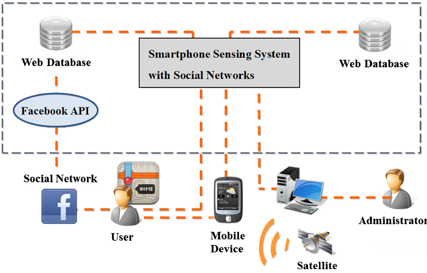 Figure 1: The overarching system architecture integrating GPS, G-sensors, and the Facebook API.
3. Gamification and Filtering
To keep users engaged, the authors designed a Planting Game. Using the phone's G-sensor (accelerometer), visitors "shake" their phones at specific locations to collect virtual seeds, which can be exchanged for real-world coupons. This serves as an Interactive Mobile Advertising mechanism, ensuring that commercial content is experienced as a reward rather than an annoyance.
Experiments & Results: Real-World Deployment
The system was prototyped for the Taipei International Flora Exposition.
- Scalability: A critical finding was that the DSR algorithm is highly scalable. Since it only needs to track the crowd status for each activity (a fixed number) rather than tracking every visitor in real-time for every calculation, the overhead remains low even as the number of users increases.
- Visual Engagement: The "Photo Sharing" function allowed visitors to see what exhibits looked like in real-time through the eyes of others before deciding to walk there.
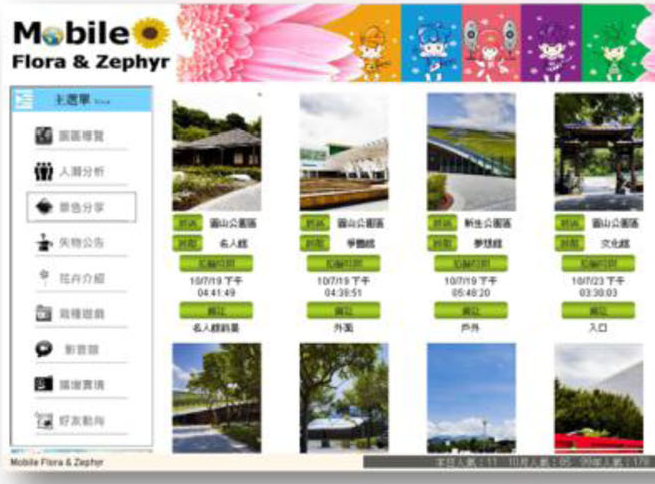 Figure 2: System prototype showing the crowd analysis and friend-finder radar in action.
Critical Analysis & Future Outlook
Takeaway
This work successfully demonstrates that Mobile Sensing is not just about data collection; it's about closing the loop between data and user behavior. By incentivizing users to move to "low-cost" areas through games and dynamic recommendations, the system naturally balances exhibition load.
Limitations
While the system is robust, it relies heavily on GPS accuracy, which can degrade in indoor pavilions. Furthermore, the reliance on Facebook (via iframe) creates a dependency on third-party APIs and constant Wi-Fi/3G connectivity, which can be spotty in overcrowded zones.
Future Work
The authors suggest that future iterations could incorporate more "Informativeness" into the LBS filter, potentially using AI to learn user preferences (e.g., specific types of flora) to make recommendations even more personalized. This moves the technology from a simple "utility" to a "personalized digital concierge."