
Tagciti: Turning the City into a Socially-Linked Information Canvas
11313_Tagciti A practical approach for location-aware and socially-relevant information creation and discovery for mobile users.
Tagciti is a novel mobile service for location-aware and socially-relevant information creation and discovery. It implements a peer-driven "tagging" ecosystem across Android and Japanese Mobile-Internet platforms, achieving high query relevance through social graph filtering rather than just geographical proximity.
TL;DR
Tagciti is a research-driven mobile platform that moves beyond static, commercial GPS directories. It allows users to "tag" the physical world with three types of data—Location Marks, Events, and Flags—while filtering these discoveries through a social graph. By prioritizing what your friends think about a cafe over what a commercial entity promotes, Tagciti creates a high-trust, low-noise mobile experience.
Problem & Motivation: The "Desktop Search" Trap
Most mobile information discovery is still stuck in the "search engine" paradigm. When you're on a street corner, you don't need a list of 1,000 restaurants; you need to know which one your friends liked or where your social group hangs out.
The authors identify three critical gaps in current systems:
- Commercial Bias: Existing services are marketing-driven, not user-interest driven.
- Context Blindness: Standard GPS apps don't understand that "The Lab" might refer to a specific room for a group of CS students but mean nothing to the public.
- High Friction: Mobile users want immediate, relevant snippets, not deep-dive web surfing.
Methodology: The Architecture of Social Relevance
Tagciti’s core innovation lies in its data structure and visibility levels. Unlike a public wiki, every "Tag" in Tagciti has a defined visibility: Personal, Up-to-friends, or Public.
1. The Three Tag Pillars
- Location Mark (LM): Permanent spots (e.g., "Best Hidden Bar").
- Event (EV): Time-limited info (e.g., "Flash Sale" or "Friday Party").
- Flag (FL): Real-time status updates (e.g., "Traffic Jam" or "Construction").
2. Technical Architecture
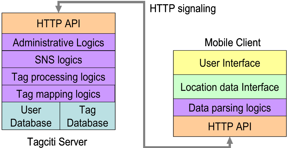
The system uses a Client-Server model. The server handles "Tag Mapping Logics"—using text-matching algorithms to see if different users are talking about the same location using different headers—and interlinks them via author and parent-tag relationships.
Multi-Platform Implementation
The researchers implemented Tagciti on two distinct fronts:
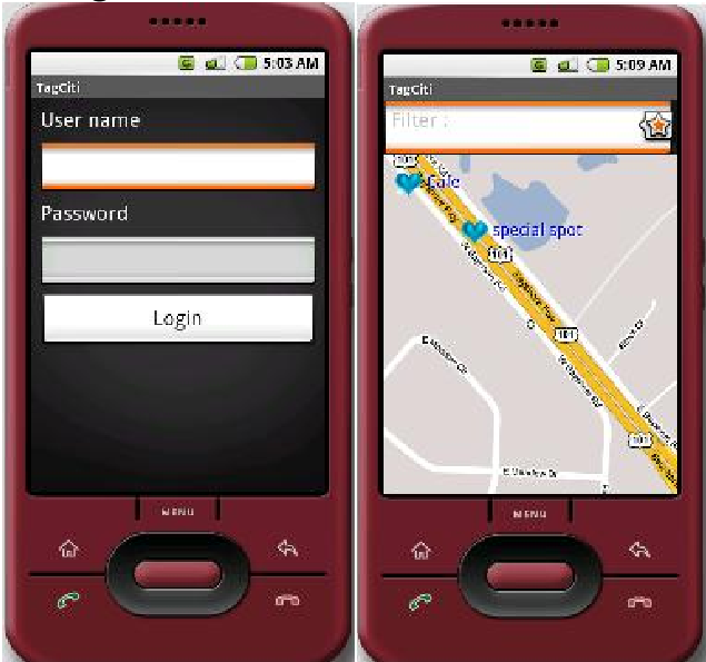
- Android OS: Leveraging local SQLite storage for caching and Google Maps for a rich, native UI experience.
- Japanese Mobile-Internet (Browser-based): Focusing on high accessibility for legacy GPS-enabled phones in Japan across carriers like NTT DoCoMo and Softbank, though it lacks the smooth map-view of the Android version.
Experiments: Proof of "Social Vocabulary"
One of the paper's most fascinating findings is the Tag Correlation study. By analyzing 38 users across Tokyo and Colombo, the authors proved that social proximity predicts semantic proximity.
| Metric | Findings |
|---|---|
| Local Friend Correlation | 48% - 59% (High agreement on local terms) |
| Global Correlation | 22% - 32% (Low agreement across different cities/groups) |
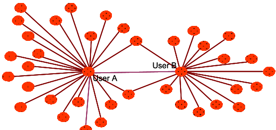
This statistical evidence supports the "Socially-Relevant" theory: people within the same friend group use similar language to describe the same places, making social-filtering far more effective than generic keyword searches.
Critical Analysis & Conclusion
Takeaway
Tagciti successfully demonstrates that social context is the ultimate filter for local data. By allowing users to create an "organic" database, the system avoids the stale or biased nature of commercial LBS services.
Limitations
- The "Cold Start" Problem: As noted in the usability test, users found "dead zones" with no tags. Community-driven apps require a critical mass before they become useful.
- Input Friction: Creating tags on a mobile browser is "cumbersome," which might deter frequent contributions.
Future Outlook
The move toward "Native-like" experiences (as seen in the Android prototype) is clearly the path forward. Future iterations involving automated sentiment analysis or AR-based tag discovery could turn Tagciti from a simple map app into a comprehensive social layer for the physical world.